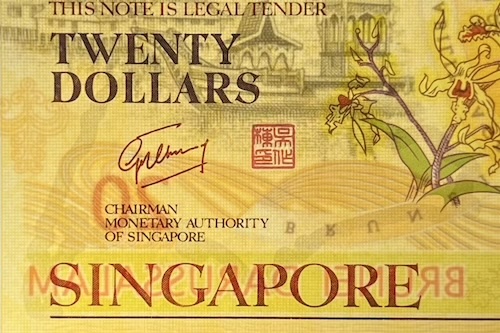
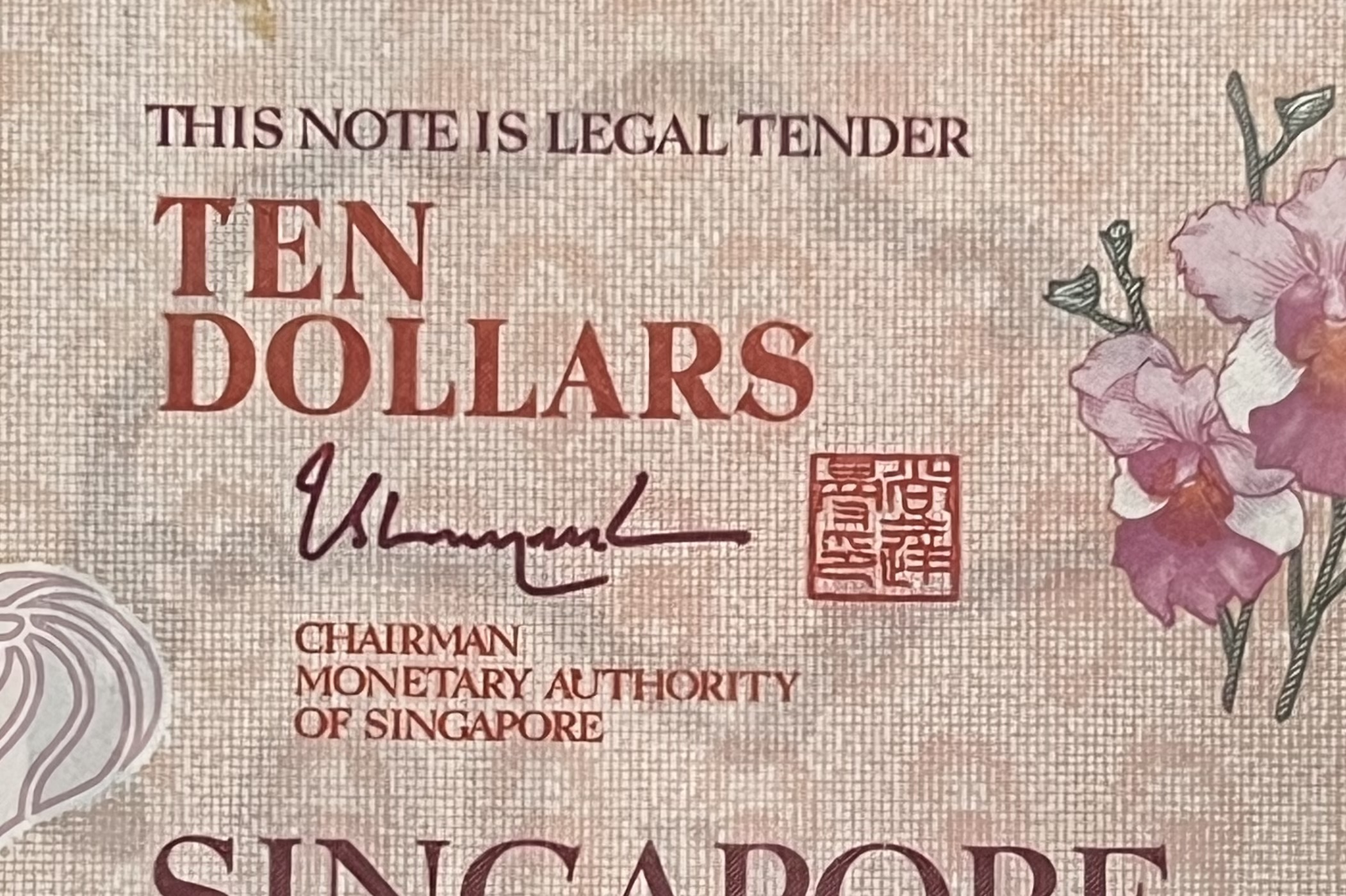
• 2007 CIA40 $20 and 2015 SG50 $10 commemorative notes
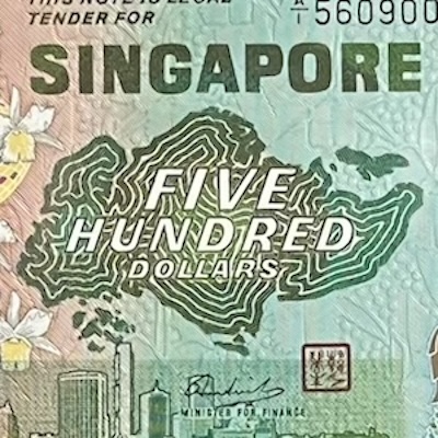
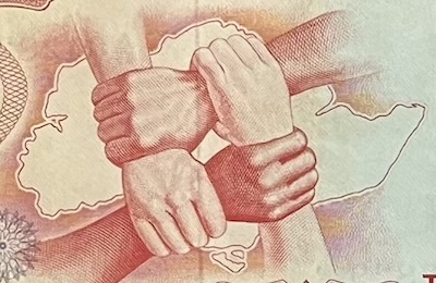
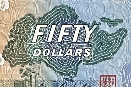
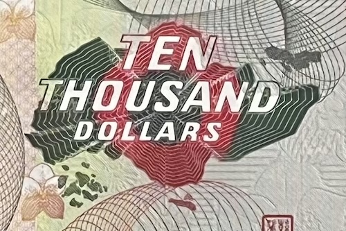
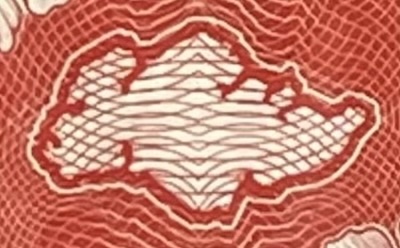
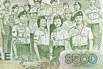
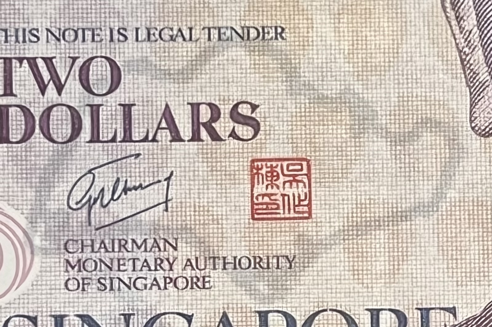
The outline map of Singapore made its first appearance in the Orchid $10 note, when it formed the background illustration behind four clasped hands: an image which represents the four races living harmoniously within our island. In the Bird Series, it is featured on the $10, $50, $500, $1000, and $10000 notes. In the Ship Series, it appears on the back of the $10 note, between the pair of Vanda Miss Joaquim flowers. It also appears subtly on the back of the $500 note, as a thin, single line super-imposed on the uniformed personnel. In the Portrait series, it is concealed as a security thread in the polymer versions of the $2 , $5, and $10 notes, and similarly in the 2007 CIA40 $20 and the 2015 SG50 $10 commemorative notes.
O10
B50
B10000
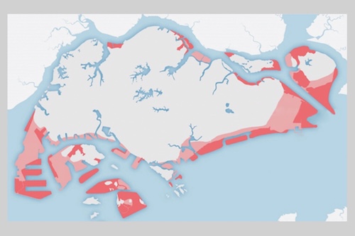
The outline of Singapore has changed over time. In 1965, when Singapore became independent, our land area was about 580 square kilometres. Since then, we have grown to about 730 square kilometres—an increase of about 25%. Reclamation projects started in the 1960s and continued for many years. Well-known places like Marina Bay, East Coast Park, Changi Airport, Tuas, and Jurong Island were all built on reclaimed land. Even parts of our Central Business District sit on land that was once sea.
S10
S500
P2
Outside our mainland, many of our offshore islands have also been reclaimed for different purposes. Pulau Tekong has been expanded through land reclamation and is used for National Service training. Sentosa started as a smaller island but was also expanded and is now a destination for tourism. Pulau Bukom, where oil is refined, has grown with more land added, and Pulau Semakau, our offshore landfill, was created by joining and reclaiming two smaller islands. Other islands like St John’s, Lazarus, and Sisters’ Islands, which are used for leisure and nature visits, have mostly stayed the same, though walkways and nearby reclamation have changed parts of the coast. There are also military training islands like Pulau Sudong, Pawai, and Senang, which have seen land changes too.
CIA40
SG50-10
Reclaimed Lands1
Today, the government continues to plan for more land reclamation to prepare for future needs like housing, industry, and protection against rising sea levels. Some key areas being looked at include the Long Island project off the East Coast, which will create new land and act as a coastal defence. There are also plans to continue expanding Tuas Port, and future developments in the Western and Southern waterfront areas. The picture above shows the land that Singapore has already added (in pink) and the land we plan to add by 2030 (in red).
Attributions
1. Image by Ministry of Defence. Source: https://www.sg101.gov.sg/resources/connexionsg.
Disclaimer. I built this website as a hobby, to share with others what I’ve learnt. All the information here is written based on my own research and understanding, and I don’t guarantee that everything is correct, complete, or updated. While I sell banknotes here, I don’t profit from them, as they are spare pieces from my private collection. All the banknote images here are taken by myself and they belong to me. The non-banknote images, with sources that I’ve attributed on every page, are used solely for illustration and non-commercial education purposes. If you are a copyright holder and believe something has been used inappropriately, please contact me, and I will immediately review or remove it.